Feeds:
Posts
Comments

Posts Tagged ‘puffin’

Last Saturday was the fourth annual City of Water Day, sponsored by the Metropolitan Waterfront Alliance. Like last year, we took Puffin over to Liberty State Park. But unlike last year, we did not have to tie up to the seawall. This year we had a slip waiting for us in Liberty Landing Marina.

But first we had to get there. We got down to our marina around 8:30 a.m. All systems seemed “go,” except when we tried to start the engine, nothing happened. Well . . . not exactly nothing: There was a click, and then nothing. This swan came over to check us out and see if he could help:

It turns out boat batteries do not last forever, and the ones in Puffin may have been the original ones from when she was launched in 2004. Fortunately, Mike, the marina manager, had a couple of batteries in stock and got them installed for us in about fifteen minutes. With the new batteries, the engine started right up, and we were on our way.

It was a bumpy ride past Coney Island to the Narrows, straight into the wind and waves. New York Harbor was its usual hustle and bustle. I monitor VHF channel 13 when in the harbor so I can know what boats are going where. One of the ones we had to look out for was MSC Bruxelles, loaded with containers and bound for Baltimore:

Photo by Karen


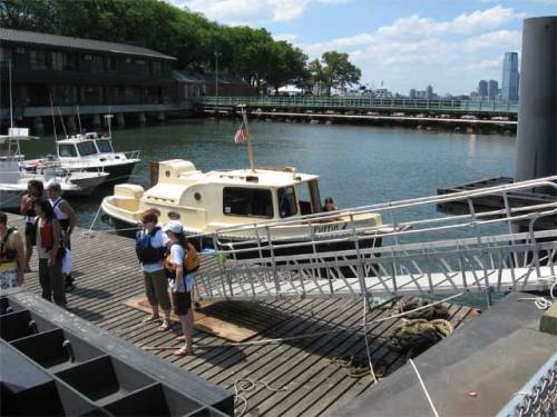
I was my usual nervous self when traversing the harbor, but thanks to Karen keeping a sharp lookout we had an uneventful crossing from Bay Ridge over to the Statue of Liberty and the Morris Canal. Michelle, the dockmaster at Liberty Landing Marina, was very helpful directing us to our slip:

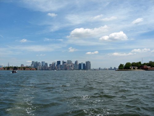
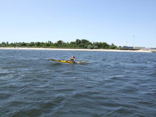
We missed the ferry over to Governors Island, so we decided to make the most of our time at Liberty State Park. We got some free ice cream, ate some lunch, and then went kayaking for an hour on the other side of the park (where we tied up last year). The views from Liberty State Park are pretty awesome. Here’s the New York skyline:

And here it looks like you can take a train from the old terminal in New Jersey straight to Manhattan:

We had a good time at our third City of Water Day. We got to spend some time in a part of the harbor that we usually just pass through and visit a new marina. But the highlight of the day was when we were getting ready to leave. A boat came into the marina, and the man at the bow looked over at us and asked — not “What kind of boat is that?” (which we’re used to hearing) — but, “Is that your Nimble?”

Turns out he’s the owner of Dunmaglass, a 1993 Nimble Nomad that he keeps in Alabama. We talked with him a bit, and he came aboard for a look around and pointed out where things are different on his boat. We would have liked to stay longer, but it was time for us to head home. After an exchange of emails, we slipped our lines and made for sea. Waves in the harbor were two to three feet, so we ducked around Governors Island and through the Buttermilk Channel. Once past the Narrows we were broadside to the waves, so we had to tack our way back to Jamaica Bay. About three hours after leaving Liberty Landing we docked back home at Sea Travelers Marina.

Read Full Post »

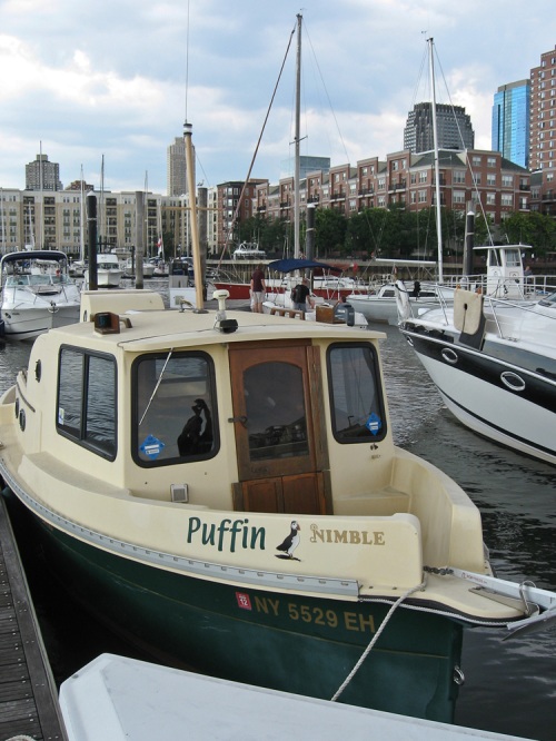
Puffin is in the water!

It may not feel like spring outside, but Puffin has been launched, and we’re eagerly looking forward to warmer, drier, calmer weather.

Here she is about to splash:


What we’re most excited about are the renovations we had done over the winter.

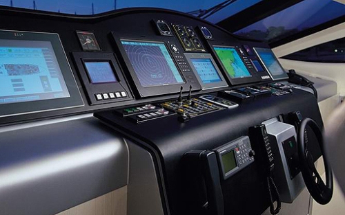
The new helm and nav station:

The main saloon:

The new head:

The hot tub:

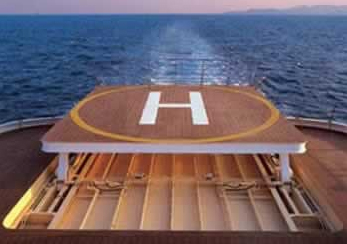
And the helipad:

Read Full Post »

Karen and I have long wanted to circumnavigate Staten Island in Puffin. I’ve always been a bit daunted by the task: a long, narrow waterway; large commercial vessels; our small, slow boat. The day after City of Water Day, after checking out the new Willis Avenue Bridge, we headed for the Kill Van Kull, where we were greeted by the Charles D. McAllister, one of many vessels plying the waters between Staten Island and New Jersey that day:

Just past Snug Harbor we noticed this raised section of pipes on the Bayonne side and what appeared to be a marina beyond it:

Based on our charts and online research, we were not expecting to find a marina on this stretch of the kill, so we went in to investigate. It turned out to be the Atlas Yacht Club. An older gentleman was heading out in a small boat, and he intercepted us and firmly (but kindly) escorted us back to the main channel. All very suspicious, until we read this article from the New York Times. The Atlas Yacht Club was originally founded by squatters, and although today it is legit, its members shy away from publicity. Thomas Murphy has some great b&w photos of the club.

Back on the Staten Island side, we saw this unidentified Reinauer tug in one of Caddell’s dry docks:

There’s a great photo gallery on Caddell’s website.

Here’s the first bridge to cross (under). It’s the Bayonne Bridge, which Karen and I walked across in April 2009:

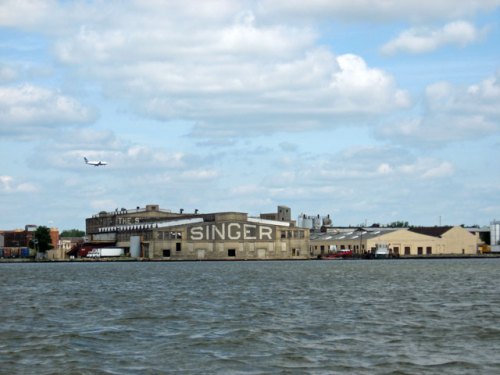
With a lot of traffic in the narrow channel on the south side of Shooter’s Island, and a very large automobile transport ship coming up behind us, we decided to take the channel to the north of Shooter’s Island. This brought us near Elizabeth, New Jersey, and this old building where Singer made sewing machines in the early 1900s:

More traffic. This is Dann Ocean Towing’s Ruby M:

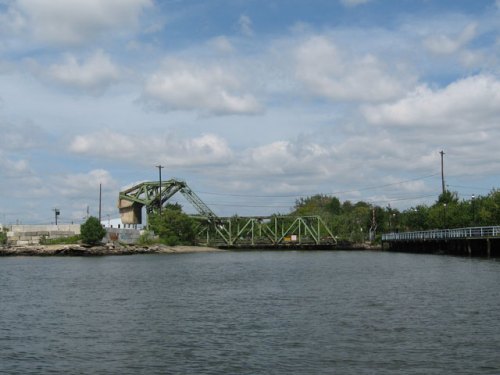
This single bascule movable bridge has a large cement counterbalance (on the left):

Often the counterbalances are below the bridge, but this bridge is at water level so there’s no room.

Commerce on the kill—containers being loaded on the Duncan Island:

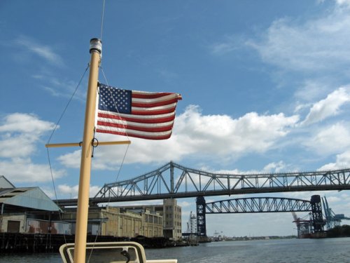
Two more bridges were passed under. The Goethals Bridge is in the foreground, and the Arthur Kill Railroad bridge (a vertical lift bridge) is behind:

This building on the New Jersey side once belonged to the General Aniline Works, a chemical plant that produced sulfuric and acetic acids as well as dyes:

This website has a lot of history and old photos of the company.

Thankfully this leviathan was moored for loading or unloading. The Atlantic Aquarius is 595 feet long:

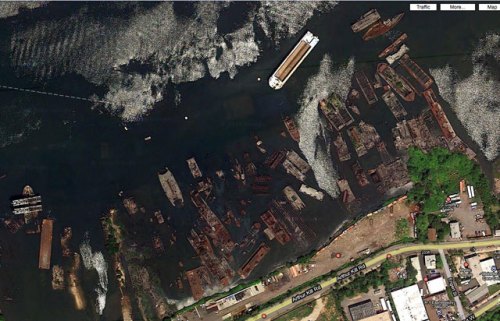
The New York side of the Arthur Kill is where old ships go to die. A graveyard there contains the remains of numerous ships. This is what it looks like in Google Maps:

And this is what it looks like from the water:

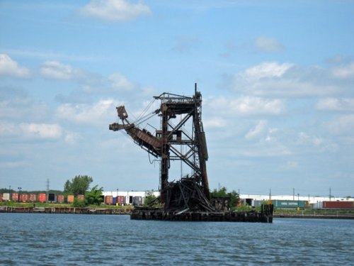
The New Jersey side has its share of dead structures and boats:

How is it that these boats and pieces of infrastructure that were once vital to industry and commerce are just abandoned and left to decay?

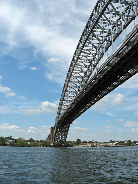
This is the last bridge before exiting the kill and entering Raritan Bay—the Outerbridge Crossing:

At the tip of Staten Island we anchored and had lunch. We then continued around the point and followed the shore up to Great Kills Harbor. At the entrance to Great Kills it was just another day at the beach for these seagulls:

We left Great Kills Harbor and headed back to Brooklyn. But the NOAA weather radio had reports of severe thunderstorms moving into the area. We tried to beat the storm to Swinburne Island, a small artificial island in the lower bay, but the wind shifted so that we were broadside to the waves. We turned around and made for South Beach on Staten Island. Close by the beach the waves were smaller, and we anchored and rode out the rest of the storm. As the wind and rain let up, we weighed anchor and set our course for home. This was the view behind us toward the west, as the sky cleared and we approached Jamaica Bay:

All photos by Karen

Read Full Post »

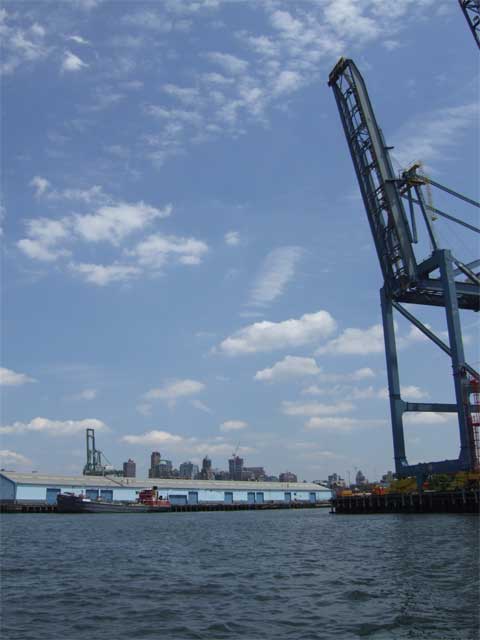
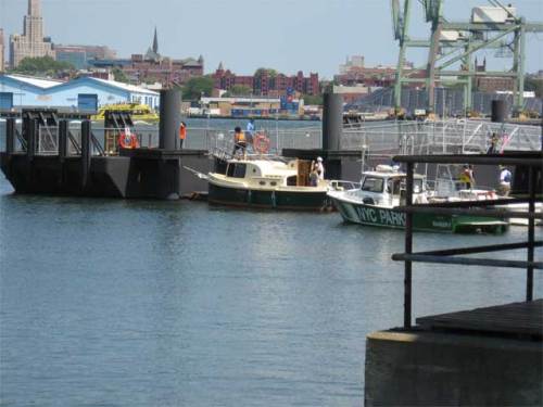
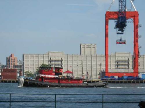
July 24th was City of Water Day in New York Harbor, sponsored by the Metropolitan Waterfront Alliance. This year’s event expanded beyond last year’s single venue of Governors Island to also include Atlantic Basin and Brooklyn Bridge Park in Brooklyn and Liberty State Park in Jersey City. Last year we made City of Water Day history by being the only non-human-powered recreational vessel to participate and dock at Governors Island (read about it here and here). This year we again took part, only we were not allowed to dock at Governors Island. (We didn’t take it personally. Well… not too personally.) We did get permission to tie up to the seawall at Liberty State Park, though, and that helped us feel like we were really participating. And we did get to visit some of the other venues, at least in passing.

First stop was Atlantic Basin, where PortSide NewYork‘s HQ, the Mary A. Whalen, is now berthed. Visiting for the day from its usual home on Manhattan’s west side was the steamship Lilac. Here’s Lilac tied up alongside the Whalen in an empty and quiet Atlantic Basin:

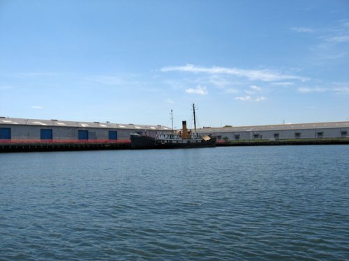
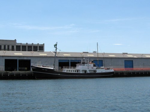
The m/v Cape Race was also visiting Brooklyn:

Cape Race was originally a deep sea trawler, built in 1963, and is now being converted into a “go anywhere in comfort expedition yacht.” The Cape Race website has lots of information and some amazing video of her in heavy seas.

Leaving Atlantic Basin, we passed north of Governors Island and caught a glimpse of the activity on shore. A quick trip across the harbor brought us between Ellis and Liberty islands on our way to Liberty State Park. Here’s the view back toward city:

And here’s Puffin tied up to the seawall at Liberty State Park:

The Hudson River sloop Clearwater took part in City of Water Day, too. Here she is making Puffin look tiny:

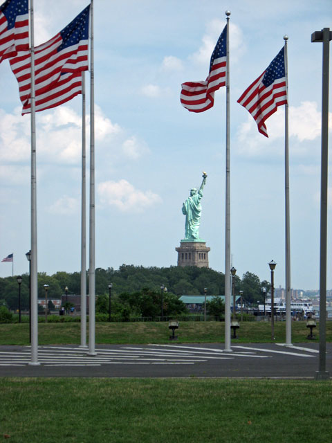
We had a lovely view of Lady Liberty’s backside from the park, a side of her not often seen by New Yorkers:

After the day’s activities wrapped up, we took Louis, one of the organizers from MWA, and George, a volunteer, for a quick circumnavigation of Liberty Island, which gave us another great view of Liberty’s aft section:

After dropping our passengers back at the park, we headed to the anchorage just beyond the park’s embayments for the night. This anchorage is quiet with good holding ground, and it’s well protected from wakes and most winds. We had it almost to ourselves:

We also had the unique opportunity to sleep within sight of both the Verrazano-Narrows Bridge and the Willis Avenue Bridge, but more on that in another post.

The moon was very nearly full, and the night was hot and clear (until a quick-moving thunderstorm passed through around 1 in the morning):

Photos 1, 2, 3, and 7 by Karen; all others by Brian

Read Full Post »

A great big thank you to Harold H. who took these photos of us in Mill Basin and Sea Travelers Marina yesterday. We have lots of pictures of Puffin at various docks, but there are very few of her under way. (The only others I know of since we’ve had her are here, taken by tugster, and at the bottom of this post, taken by frogma.)

Full speed ahead! (Note the traffic on the Belt Parkway behind us. Glad we weren't in a car!)

Profile

In the marina, just before the first attempt to dock.

Here’s another interesting shot. Since puffins fly as well as swim, here’s a picture of Puffin in the air:

First three photos by Harold H.; last one by me.

Read Full Post »

Puffin was finally launched on Saturday. She went in much later than usual due in part to the damage sustained by Sea Travelers Marina during last March’s intense storm. About a month ago I took the shrink-wrap off and waxed the hull, and yesterday Karen and I spent a couple of hours washing the boat.

Today, with a stiff breeze blowing from the east, we headed out with our friends Jon and Elisa. The blue line shows where we went—around Floyd Bennett Field, past Dead Horse Bay, and into Gerritsen Creek where we dropped the hook for some lunch.

Waves were about 1 1/2 to 2 feet, which doesn’t sound like much but makes for a bumpy ride when going into them. It was windy but flat inside Gerritsen Creek. Jon went for a swim in the 66-degree water, but the rest of us stayed on the boat.

The trip back to the marina was pretty smooth, but it was still blowing, and I wondered how the docking would go.

It didn’t go well. I tried pulling into the slip the way I usually do, but the wind caught the stern and spun the boat. I didn’t want to bump onto the corner of the slip, so I tried reversing out and turning around. The wind wouldn’t let me turn the boat around, so I ended up reversing back past the slip for a second try. It didn’t go much better than the first, but fortunately a spectator came by and grabbed the bow. I jumped onto the dock, and the two of us were able to  walk the boat into the slip.

We were not the only ones to have trouble. The boat that went in ahead of us also had to make two attempts. I’m not sure what I would have done if I’d been alone.

Other than that, it was a fine (belated) start to the boating season.

Read Full Post »

Here are some more pictures from our July trip up the Hudson River. There are seven lighthouses on the river; presented here are six of them. Do you know which one is missing? Here they are, from south to north.

First is the Little Red Lighthouse (nestled beneath the Great Gray Bridge). This tower’s light was first lit in 1895.

little_red

Next up is the Sleepy Hollow Lighthouse, formerly known as the Tarrytown Lighthouse or the Kingsland Point Lighthouse. It was first lit in 1883. (This was taken on a slightly rough day, and we didn’t get too close; we were more interested in getting to that day’s stopping place—Alpine Boat Basin.)

sleepyhollow

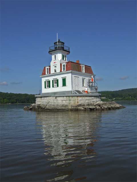
Farther up the river is the Esopus Meadows Lighthouse. The first lighting of the current tower was in 1872. Note the guys in orange painting the building. They were a work crew from some prison (one of the sweeter gigs, I would think). You can see the guard just to the right of the building. He was watching very carefully as we came by and took pictures; he really had no idea what a lousy getaway vessel Puffin would make!

esopus

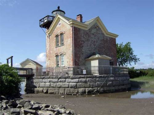
The Rondout Lighthouse is just outside Kingston, NY, the first capital of New York State. The first lighthouse here was built in 1838, but the current building dates from 1915. The Hudson River Maritime Museum runs tours out to this one.

rondout

The really cool thing about the Saugerties Lighthouse is that you can stay in their bed and breakfast (but you have to make your reservations way in advance). The first lighting of this tower was in 1869.

saugerties

The northernmost lighthouse on the Hudson is the Hudson-Athens Lighthouse. This is the original building on this site. It was built and first lit in 1874.

hudson-athens

For more information on these lighthouses (and to discover which one is missing from these photos), check out the Hudson River Lighthouse Coalition.

All photos, except the first one, by Karen

Read Full Post »

Here’s a pictorial review of City of Water Day.

This is the tug Pegasus, heading toward Erie Basin or Gowanus Bay on a tour:

pegasus

Karen got this dramatic shot of the Mary A. Whalen and one of American Stevedoring‘s gantry cranes:

whalen

They’re one of the companies keeping the working waterfront working.

Here’s another shot of Puffin, secure at Pier 101. That’s Karen standing in the stern:

puffin_101

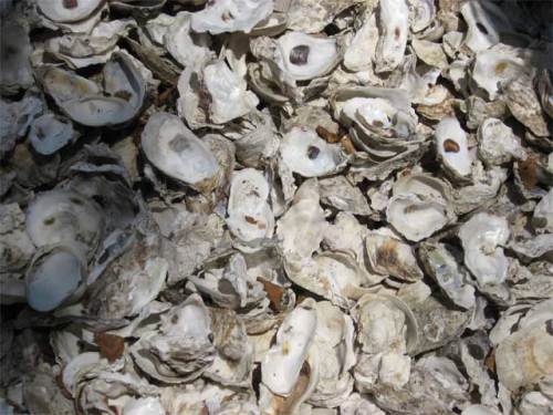
There was an exhibit on Governors Island discussing the role of the oyster in the ecological and commercial history of New York City. It also explained the efforts to bring the oyster back to New York Harbor. Accompanying the exhibit was a small oyster shell midden:

midden

To learn more about oysters and New York City I highly recommend Mark Kurlansky‘s The Big Oyster: History on the Half Shell. (Yes, I know. That’s the second time I’ve recommended a Kurlansky book. I’m not on his payroll; I just really like his stuff.)

The scene at the boat landing:

kayaks

This plaque commemorates the purchase of Governors Island by Wouter van Twiller in 1637. The remarkable thing about the plaque is that it mentions the names of the two Manahatas from whom the island was purchased:

plaque

Here’s good old Wouter (second from left, I’m guessing):

Wouter_van_Twiller

I wonder what “two axe heads, a string of beads and a handful of nails” would buy today.

The tug Cornell passes the Brooklyn waterfront:

cornell

Governors Island is also hosting various art installations. This is one—made up of light and smoke—inside the chapel:

art

For a lot more information about Governors Island, and particularly for some fantastic historic maps and images (including one of Wilbur Wright taking off), go to the Web site of the Governors Island Preservation and Education Corporation (GIPEC).

And if you, like us, would like docking for recreational boaters to be part of Governors Island’s future, please let GIPEC know.

For more pictures from me and Karen, visit my web gallery.

Read Full Post »

Today was City of Water Day in New York, sponsored by the Metropolitan Waterfront Alliance. Hundreds (thousands?) of people came to Governors Island just off the Battery by ferry, canoe, kayak, rowing gigs, and one lone private powerboat.

Karen and I arrived at Pier 101 in Puffin around 1:00 p.m. We tied up at one dock but had to move to make way for bunches of kayakers. The next spot was too close to some beautiful wooden rowing boats, so we moved to a third spot. This one was a bit bumpy as the ferries came and went, but we put out all our fenders, and the boat is secure:

IMG_5123_sm

City of Water Day looked to be a tremendous success. Tons of people were on Governors Island, listening to music, fishing, seeing art installations, and visiting with representatives of local water access advocacy, educational, and environmental groups.

We are now camping on the ballfields with a couple hundred paddlers and rowers. The view of Jersey City is very nice. (We’re too far south on the island to see Manhattan.)

When I first came ashore this afternoon I planted my flag and announced, “I claim this land in the name of recreational boaters.” GIPEC, are you listening?

photo 071809 001

Read Full Post »

We survived our night at the Alpine Boat Basin. In fact, once it was nearly high tide and I realized our lines were set well, and when it became obvious that the predicted horrible thunderstorm was only going to bring a lot of rain and no thunder, we ended up having one of the best nights. I was pretty sure I wasn’t going to get a lot of sleep, as I watched the tide come in and the planks to Puffin‘s starboard were submerged, but my fears were unfounded.

puffinalpine_sm

Alpine does have this going for it: at $1/foot it is the cheapest place to stay along the whole Hudson River (except for Waterford, which is free).

Heading down the Hudson we met the North River, one of the Department of Environmental Protection‘s sludge vessels:

northriver_sm

This was an appropriate end to our river cruise, as the Hudson River was once called the North River (and still is by today’s commercial captains).

We then took the Buttermilk Channel around Governors Island and went over to see if Carolina was around on PortSide NewYork‘s headquarters, the Mary A. Whalen:

whalen_smShe wasn’t.

Entering the home stretch in Jamaica Bay, we spotted Frogma out for a paddle:

frogma1_sm

In all the time we’ve been boating in Jamaica Bay, this was the first time we met on the water. There she goes, off toward the Gil Hodges Memorial Bridge:

frogma2_sm

All in all, it was an amazing trip. Karen and I both feel a much stronger connection to the river. It is one thing to drive up the Thruway or take the train to Albany; it is altogether a different thing to spend a week on the water, rarely going more than 8 m.p.h., spending almost no time on land, and not straying more than a mile from the river’s shores.

Top 2 photos by Brian; the other 3 by Karen

Read Full Post »

Older Posts »