I’ve added a new link in the blogroll, under Miscellany. This site has the most amazing, clever maps that show all sorts of things. They’re all fascinating, but make sure to check out this one in particular, which shows which American television shows have reached which stars.
Archive for July, 2009
A Most Interesting Site
Posted in interlude on July 27, 2009| Leave a Comment »
City of Water Day (with photos)
Posted in bridges & boats, tagged books, city of water, governors island, history, new york, new york harbor, oysters, puffin on July 25, 2009| 1 Comment »
Here’s a pictorial review of City of Water Day.
This is the tug Pegasus, heading toward Erie Basin or Gowanus Bay on a tour:
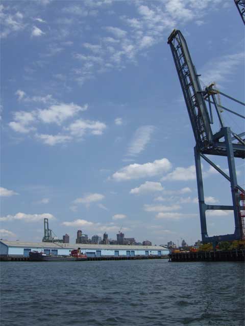
Karen got this dramatic shot of the Mary A. Whalen and one of American Stevedoring‘s gantry cranes:
They’re one of the companies keeping the working waterfront working.
Here’s another shot of Puffin, secure at Pier 101. That’s Karen standing in the stern:
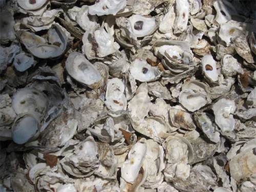
There was an exhibit on Governors Island discussing the role of the oyster in the ecological and commercial history of New York City. It also explained the efforts to bring the oyster back to New York Harbor. Accompanying the exhibit was a small oyster shell midden:
To learn more about oysters and New York City I highly recommend Mark Kurlansky‘s The Big Oyster: History on the Half Shell. (Yes, I know. That’s the second time I’ve recommended a Kurlansky book. I’m not on his payroll; I just really like his stuff.)
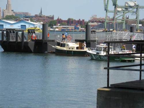
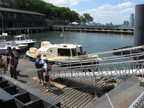
The scene at the boat landing:
This plaque commemorates the purchase of Governors Island by Wouter van Twiller in 1637. The remarkable thing about the plaque is that it mentions the names of the two Manahatas from whom the island was purchased:
Here’s good old Wouter (second from left, I’m guessing):
I wonder what “two axe heads, a string of beads and a handful of nails” would buy today.
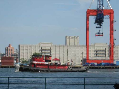
The tug Cornell passes the Brooklyn waterfront:
Governors Island is also hosting various art installations. This is one—made up of light and smoke—inside the chapel:
For a lot more information about Governors Island, and particularly for some fantastic historic maps and images (including one of Wilbur Wright taking off), go to the Web site of the Governors Island Preservation and Education Corporation (GIPEC).
And if you, like us, would like docking for recreational boaters to be part of Governors Island’s future, please let GIPEC know.
For more pictures from me and Karen, visit my web gallery.
I claim this land…
Posted in bridges & boats, tagged city of water, governors island, new york, new york harbor, puffin on July 18, 2009| 4 Comments »
Today was City of Water Day in New York, sponsored by the Metropolitan Waterfront Alliance. Hundreds (thousands?) of people came to Governors Island just off the Battery by ferry, canoe, kayak, rowing gigs, and one lone private powerboat.
Karen and I arrived at Pier 101 in Puffin around 1:00 p.m. We tied up at one dock but had to move to make way for bunches of kayakers. The next spot was too close to some beautiful wooden rowing boats, so we moved to a third spot. This one was a bit bumpy as the ferries came and went, but we put out all our fenders, and the boat is secure:
City of Water Day looked to be a tremendous success. Tons of people were on Governors Island, listening to music, fishing, seeing art installations, and visiting with representatives of local water access advocacy, educational, and environmental groups.
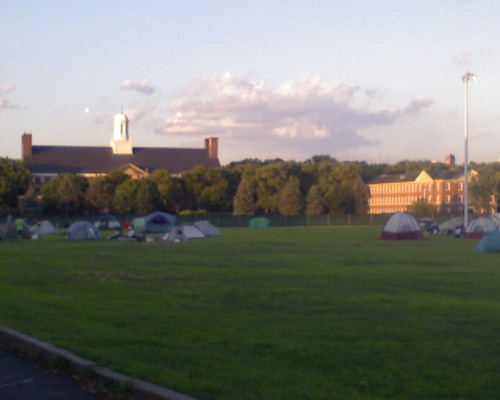
We are now camping on the ballfields with a couple hundred paddlers and rowers. The view of Jersey City is very nice. (We’re too far south on the island to see Manhattan.)
When I first came ashore this afternoon I planted my flag and announced, “I claim this land in the name of recreational boaters.” GIPEC, are you listening?
Home!
Posted in bridges & boats, tagged alpine boat basin, hudson river, jamaica bay, new york harbor, puffin on July 13, 2009| 2 Comments »
We survived our night at the Alpine Boat Basin. In fact, once it was nearly high tide and I realized our lines were set well, and when it became obvious that the predicted horrible thunderstorm was only going to bring a lot of rain and no thunder, we ended up having one of the best nights. I was pretty sure I wasn’t going to get a lot of sleep, as I watched the tide come in and the planks to Puffin‘s starboard were submerged, but my fears were unfounded.
Alpine does have this going for it: at $1/foot it is the cheapest place to stay along the whole Hudson River (except for Waterford, which is free).
Heading down the Hudson we met the North River, one of the Department of Environmental Protection‘s sludge vessels:
This was an appropriate end to our river cruise, as the Hudson River was once called the North River (and still is by today’s commercial captains).
We then took the Buttermilk Channel around Governors Island and went over to see if Carolina was around on PortSide NewYork‘s headquarters, the Mary A. Whalen:
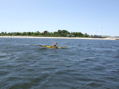
Entering the home stretch in Jamaica Bay, we spotted Frogma out for a paddle:
In all the time we’ve been boating in Jamaica Bay, this was the first time we met on the water. There she goes, off toward the Gil Hodges Memorial Bridge:
All in all, it was an amazing trip. Karen and I both feel a much stronger connection to the river. It is one thing to drive up the Thruway or take the train to Albany; it is altogether a different thing to spend a week on the water, rarely going more than 8 m.p.h., spending almost no time on land, and not straying more than a mile from the river’s shores.
Top 2 photos by Brian; the other 3 by Karen
In Praise of Floating Docks
Posted in bridges & boats, tagged alpine boat basin, floating docks, hudson river, puffin, tides on July 11, 2009| 1 Comment »
One of the reasons we hung out at Half Moon Bay was because a photographer from Northeast Boating was coming to take pictures, and we were hoping he would put Puffin in the magazine. The photographer arrived and walked past us with barely a glance in our direction, so we decided to leave.
Conditions in Haverstraw Bay were rougher than yesterday — south winds at 15-20 knots, with 2- to 3-foot waves (some perhaps 4 feet). It was a very bumpy trip, and we were glad to arrive at the Alpine Boat Basin in New Jersey. Glad, that is, until we discovered that Alpine is an old style marina with fixed, rather than floating, docks. Puffin is in a slip that is 41 feet long and 16 feet wide. It took us two hours to get dock lines set up in a way that will allow us to rise and fall with the tide without either hanging from our lines or floating all over the slip. Never again will we take for granted the convenience of floating docks.
Other than that, Alpine is in an amazing spot at the base of the Palisades, and now that we have the lines set it is fairly comfortable.
Half Moon Bay Marina, Croton-on-Hudson, NY
Posted in bridges & boats, tagged croton-on-hudson, hudson river, puffin on July 11, 2009| 1 Comment »
This morning we’re hanging out at Half Moon Bay Marina in Croton-on-Hudson, NY:
According to the readers of Northeast Boating magazine this is the best marina in the northeast. It is very nice, and we’ve delayed our departure to enjoy it longer.
Yesterday we anchored behind Pollepel Island for lunch and a nap. We’re a day ahead of schedule, so we knew we didn’t need to push too hard. We thought we might spend the night in Peekskill. After lunch, the tide turned to be in our favor, and we weighed anchor and headed down the river.
We’ve been playing tag with the tug Scott C and the barge Liberty for days, and yesterday they overtook us as we passed Breakneck Ridge:
As we neared Peekskill we began trying to arrange docking for the night. Phone calls to both the Peekskill Yacht Club and the Charles Point Marina went unanswered, as did calls on the radio. We went into Charles Point Marina to see if we could find a person. The place looked deserted — there were a few boats in slips and a lot of brand new docks waiting to be installed, but we didn’t see anybody who seemed to be in charge. We tied up in a slip, and Karen went ashore to find, well, anyone. She found one person who worked in repairs; he was leaving for the day and had no idea if we could stay or not. We decided to beat a hasty retreat.
A few more phone calls to marinas did not lead to a slip for the night, until we reached Steve at Half Moon Bay. We plugged the coordinates into the GPS and headed into Haverstraw Bay. This area of the river is quite wide, and the wind had been blowing steadily from the south, so we had choppy conditions with 1- to 2-foot waves. This picture doesn’t really capture it, but we had spray over the bow for most of the transit of the bay:
These conditions were quite a change for us after days on the smooth waters of the upper river.
It was supposed to be an easy day, but we ended up doing 51 nautical miles. After we arrived at Half Moon Bay, Karen’s parents took us to a great dinner in Croton, which we appreciated hugely. The food from packets and boxes has actually been quite tasty, but it sure was good to eat a real meal with vegetables and everything!
Hudson River Maritime Museum, Kingston
Posted in bridges & boats, tagged henry hudson quadricentennial, hudson river, hudson river maritime museum, kingston, puffin on July 9, 2009| Leave a Comment »
We are now docked at the Hudson River Maritime Museum in Kingston. We have the entire dock to ourselves:
The museum has a really great deal for boaters. For the price of an annual membership and $1.50 per foot we get to stay overnight on their dock, with electric hookup and water included. Plus, now that we’re members, we got to visit the museum for free. They have really great exhibits and artifacts from the history of the river and a special exhibit about the Fulton steamship centennial and Henry Hudson tricentennial celebrations of 1909.
The trip down from Catskill was very quick. We had the tide with us the whole way, and we made such great time that we were able to duck into Saugerties and check out the town and lighthouse.
Despite the ebbing tide, the surface of the river was the smoothest we’ve seen yet. Karen captured it in these pictures:
And finally, after days of searching, we spotted the replica of Henry Hudson’s ship. Here is the Halfmoon:
Rolling Home
Posted in bridges & boats, tagged albany, catskill marina, hudson river, movable bridge, puffin, troy lock, waterford on July 8, 2009| 1 Comment »
Last night in Waterford we noticed that the water level had dropped and our dock lines were quite taut, and we had to step down from the wall to Puffin‘s roof. This surprised us, since we didn’t think there were tides at Waterford. This morning, our dock lines were quite slack, and we had to step down from Puffin‘s roof to the wall. This really confused us. It turns out that the water level is controlled by the dam at Troy Lock, and they had lowered the level, probably because of all the rain.
Leaving Waterford this morning, we pointed our bow south and started the return to trip to Brooklyn. We made a smooth passage back through Troy Lock and spotted this mural just above Troy Dock:
It seems that everyone is trying to cash in on Uncle Sam. The same Sam who lived near Catskill is buried in Troy.
I forgot to get a picture of the Albany swing bridge on the way north, but I did get it today:
We expected to see Half Moon during this trip, but so far the only thing we’ve spotted that looks like it might be Half Moon is this wind vane atop an Albany building:
The weather was quite cool today and mostly cloudy. Here are the Catskill Mountains under a thick blanket of clouds:
We got rained on a bit while out on the river, and that helped us make the decision to put in once again at Catskill Marina instead of pushing on farther. We got our regular slip and were greeted by Al, who hasn’t managed to leave the marina yet (it’s that nice here). It has rained on-and-off since we’ve been here, quite hard at times. Guess we won’t be using the pool tonight.
Off the Chart!
Posted in bridges & boats, tagged hudson river, movable bridge, puffin, troy lock, waterford on July 7, 2009| 1 Comment »
Today we fell off the edge of the world. At least the edge of the world as contained on our Battery-to-Troy nautical chart. It was an exciting end to a day that had its fair share of excitement and, well, less excitement.
Leaving Catskill this morning, we continued north through a rather dull stretch of the river. The surrounding landscape was quite flat, and there wasn’t much to look at, although what there was was pretty enough. The town of Coxsackie looks quite attractive from the water. (I know nothing about what it looks like from land, so I’m not in any way disparaging the town.)
The tide was against us, so the going was slow. But the monotony was soon broken by the sudden appearance to the west of a line of strong thunderstorms. As the wind and rain started, we made an unplanned stop at Shady Harbor Marina, in New Baltimore, to wait out the storm.
Continuing north we soon saw the towers of Albany’s Empire State Plaza peeking over the trees. We stopped to refuel at the Albany Yacht Club:
A few miles beyond Albany we passed under this vertical lift bridge in Troy:
It looks nice and sunny, but thunderheads were once again forming to the west, and the NOAA weather radio was reporting a severe thunderstorm warning for our area. We decided to press on to Troy Lock (also known as Federal Lock or Lock 1), the end of the Hudson River tidal estuary. The dam at the lock prevents the tides from going farther north.
We entered the lock and made it through smoothly as the sky went from dark to seriously dark:
As we motored the last few miles to Waterford, NY, we hoped we would beat the rain. But it was not to be. The lightning and thunder began as we were approaching the wall at Waterford where most boaters tie up. Waterford is at the junction of the Erie and the Champlain Canals:
We turned west and tied up to the wall, where we will spend the night:
All photos by Karen.
Catskill Marina
Posted in bridges & boats, tagged catskill, catskill marina, henry hudson quadricentennial, hudson river, puffin on July 6, 2009| 1 Comment »
A better title for this post would be “Don’t Go Back to Newburgh!” Our initial favorable impression of Newburgh and its waterfront began to fade around 9:00 p.m. when we realized the incredibly loud music from the waterfront bar wasn’t going to end anytime soon. In fact, it didn’t end until around 12:45 a.m. when we were then able to hear the guitar-playing singer at the restaurant next door. He kept going until a bit after one.
Other than that, though, it was a nice enough place. The moon was nearly full, and the water was calm.
My father told me this morning that I was in Newburgh by boat a mere 42 years ago. It must have been quieter then.
This morning there was barely any traffic on the river, and the water was as smooth as glimmer glass, as my grandfather used to say. (It was his boat I was on that first time in Newburgh.)
We had the tide with us most of the day and cruised along at nearly 8 knots. We chased down, and eventually passed, the John Reinauer, which was pushing two fuel barges. They passed Newburgh shortly before we slipped our lines, and we didn’t catch them until we had almost arrived in Catskill.
Catskill Marina (where we are now) is another place I visited 42 years ago. That’s me in the sailor hat:
It is the complete opposite of Newburgh, a quiet marina up the Catskill Creek. The facilities and showers are spotless, there’s barely a ripple in the creek, and birds are singing.
Catskill Marina is also where we acquired our national ensign. Our neighbor at the dock, Al of Dream Catcher from Schuylerville, NY, was incredibly friendly and generous. We were talking boats with him, and we mentioned that we couldn’t figure out where to put a flag on Puffin. He said he had an extra one and went below to find it. Here we are with our brand-new flag proudly flying from Puffin‘s mast:
We took a walk into town and visited Main Street. As part of the Hudson Quadricentennial, Catskill has decorated itself with painted cats.
Here’s “Half Moon Kitten”:
And here’s “Cat’n Henry Hudson”:
We’re a bit surprised that we haven’t seen more goings-on around the quadricentennial during our journey. Other than the cats in Catskill, all we’ve seen are lots of Explore NY 400 flags. And this banner at Catskill’s Cone-E Island ice cream shop:
See the bridge behind the banner? According to an 1867 map displayed in a shop window, it’s a movable bridge. We think the current “Uncle Sam Bridge” has replaced that one. This bridge was named for the guy who inspired the Uncle Sam character. He lived near Catskill from 1817 to 1822, which I guess is significant enough to warrant having a bridge named for him.

