Feeds:
Posts
Comments

Ice! III

Six years ago, Karen and I headed up the Hudson River (by car) to find ice. Three years ago we had to go farther north, to Québec City, to find ice. This year the ice came to us.

Today, with the temperature around 16 degrees Fahrenheit and the windchill somewhere south of zero, we took a tour with the New York City Audubon Society and New York Water Taxi to look for birds and harbor seals. We found wind (30–35 knots, with gusts much higher), waves, and lots of ice.

Icy harbor

Water taxi in the ice

The tug Chesapeake Coast enters the Buttermilk Channel between Governors Island and Brooklyn:

Chesapeake Coast

At least the ice helped calm the water:

Frozen buoy

Here’s a close-up of the ice at the entrance to Erie Basin:

Frozen harbor

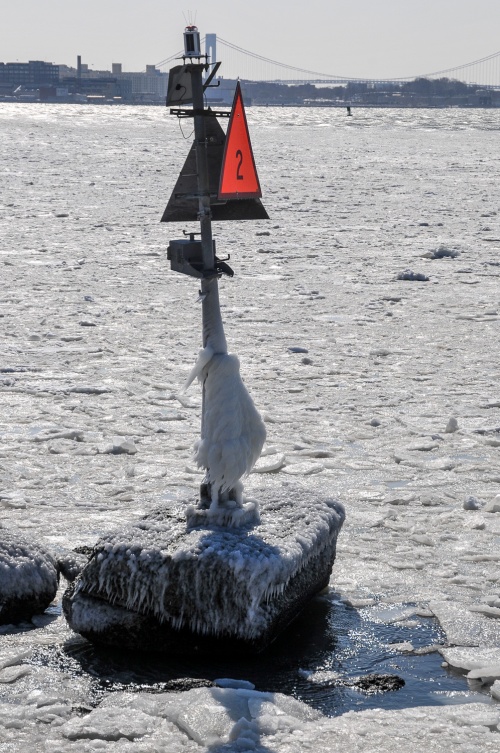
And here’s the buoy marking the entrance:

Ice-covered buoy

After poking around in Erie Basin, we headed through the Narrows to Hoffman and Swinburne islands to see if we could find harbor seals. This is the crumbling pier at Hoffman Island (no seals):

Frozen pier

Then on to Swinburne Island. Still no seals (although the Audubon Society naturalist leading the tour claimed to have seen one poke its head up behind us), but plenty of birds:

Birds at Swinburne Island

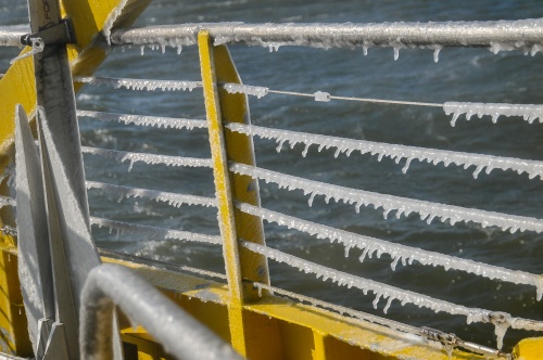
This is what the boat looked like when we got back to the South Street Seaport:

Icicles

Frozen boat

All in all a fun trip (the free hot chocolate helped a lot), and we did get to see some arctic birds that are only here in the winter.

This past Sunday, Karen and I joined a group of volunteers on a marsh restoration project in Jamaica Bay, organized by the American Littoral Society and other environmental groups. About 85 percent of the wetlands in Jamaica Bay have disappeared, resulting in lost habitat for fish, birds, and other wildlife. In addition, wetlands provide natural flood control, which the community of Broad Channel, Queens, could have benefitted from during Hurricane Sandy. For more on the project, click here.

Sunday was cold, windy, and rainy, but we decided to go anyway, knowing we would regret missing the opportunity to be part of the first ever community-led restoration project on national land (Jamaica Bay is part of the Gateway National Recreation Area). To get to Rulers Bar Hassock, where the Spartina marsh grass was waiting to be planted, we had to take a boat from Broad Channel to a float moored just off the island. We then pulled the float as close to Rulers Bar as we could get it and waded through ankle-deep water and mud to the island:

rulers bar-1

Here we are on the island, dressed for foul weather:

rulers bar-3Rulers Bar is eight acres of sand that gets covered twice a day by the high tide. The Spartina plugs get planted two feet apart and a few inches deep. It’s amazing that the tide doesn’t wash them away. The plugs along the fence are still in trays, and plugs planted the day before are arranged across the sand in rows:

rulers bar-4There’s a lot more island to cover:

rulers bar-2

Rulers Bar HassockIf I remember correctly, the plan is to plant 88,000 plugs, with a goal of 85 percent survival to next year. More than 10,300 plugs were planted last weekend.

The proces is quite simple: make holes in the sand, remove plugs from the tray, place one in each hole, cover with sand and pat it down. The tool for making the holes is a dibble. Here Karen gets her dibble on:

rulers bar-6What is the collective noun for a group of volunteers? An army? A horde? A scattering? Anyway, the turnout on Sunday was quite large, especially given the weather:

rulers bar-7There are three more days of planting. To join the fun (and do some good) click any of these links:

May 25th, 11 am – 3 pm

May 26th, 12 pm – 4 pm

June 2nd, 10:30 pm – 2:30 pm


vermont sail freight

In a bit of a departure from the usual fare here on A Movable Bridge, I’d like to draw your attention to the Vermont Sail Freight Project.

Erik Andrus of Ferrisburgh, Vermont, has developed this demonstration project to show how sailing vessels can be used to deliver non-perishable Vermont-produced foods to markets in the Lower Hudson Valley and New York City. He and a bunch of volunteers are currently at work building the boat, whose design is based on that of Thames River sailing barges.

As of this morning they had received $14,338 in pledges toward the $15,000 goal on Kickstarter. There are nine days left in which to pledge. Click here to learn about the project on Kickstarter and to make a pledge.

For full information about the project, visit the Vermont Sail Freight Project website.


Connecticut River ferry

On our frequent drives up to Massachusetts we pass a sign on I-91 that says, “Connecticut River Ferry, April 1 to October 31,” and one of us always says, “We should check that out someday.” This past October, just a couple of weeks before the ferry closed for the season, we finally did it.

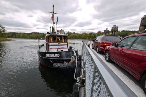
The ferry is the Rocky Hill–Glastonbury Ferry, and it’s the oldest continuously operating ferry in the United States. Vessels of various sorts have been providing service at this site since 1655. Today the towboat Cumberland pushes the Hollister III back and forth.

ct river ferry-1


The Cumberland controls the barge with just two lines that run from the towboat’s bow to two points along the side of the barge. In the picture above, the barge is being held against the Glastonbury bank waiting for another car to board.

Now the Cumberland has begun to pull the barge off the bank:

ct river ferry-2


In the next two pictures she’s turning around and preparing to push the barge across the river:


ct river ferry-3


ct river ferry-4


Full speed ahead:

ct river ferry-5


Connecticut River Ferry


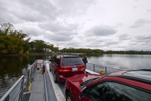
That’s Glastonbury up ahead:

ct river ferry-6


If you find yourself in this part of Connecticut, the chance to step (or drive) into history is totally worth the three-dollar fare to take your car on the ferry.

The Falkirk Wheel

This post is way overdue.

Last August, Karen, the kids, and I went to Great Britain. (Click here to read about our trip on the Regent’s Canal in London.) In Scotland we made sure to visit the Falkirk Wheel.

falkirk wheel-4

falkirk wheel-1

This unusual device is essentially a canal lock. It’s used to move boats between the Forth and Clyde Canal and the Union Canal. Boats enter at the top or bottom, and then the whole thing rotates 180 degrees.

Tour boats operate on the canals and give visitors the chance to experience the wheel firsthand, but unfortunately it took us longer to get out of Edinburgh than we expected, and we arrived too late to take a ride. We did get to see one of the boats come along the Forth and Clyde Canal

falkirk wheel-2

and enter the lock that connects the canal with the basin at the bottom of the wheel:

falkirk wheel-3

Construction on the Forth and Clyde Canal began in 1768. The canal was closed in 1963 and reopened in 2001. The Falkirk Wheel began operation in 2002 and replaced a series of eleven locks that used to connect the two canals.

Here’s a brief stop-motion video showing the wheel in motion:

Regent’s Canal, London

The Regent’s Canal in London provides a connection between the River Thames at Limehouse Basin and the Grand Union Canal.

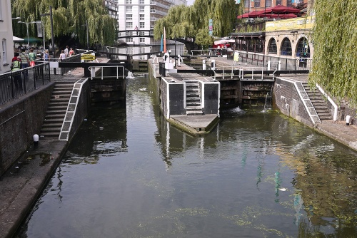
We took a narrow-boat tour from Camden Town to Little Venice. This short portion of the canal passes through the London Zoo, Regent’s Park, and the 270-yard-long Maida Tunnel before arriving in Little Venice. A few companies offer tours on the Regent’s Canal, but we chose to go on the Jenny Wren so we could pass through a lock, lock number 1 at Hampstead Road:

The part of the canal we visited is the oldest, opened in 1816. To this day, locks on the canal are manually operated:

The narrow boats just fit:

Here’s the view from inside lock number 1, aboard the Jenny Wren:

The canal is home to many live-aboards, with their brightly colored and decorated boats:

Not necessarily the best scenery:

But it is waterfront property:

At Little Venice there was a waterborne market and a chance to buy ice cream from a canal boat:

It was the last day for the market, and the zebra-striped boat above was preparing to head home to Stratford-upon-Avon, a two-weeks’ voyage (if I remember correctly).

A movable bridge most grand

On a recent trip to London, Karen, the kids, and I visited Tower Bridge. It took eight years, starting in 1886, to build this double-bascule bridge:

The two towers and the upper walkways contain an exhibit about the history and construction of the bridge. The walkways also provide great views of London:

The pointy building on the left is the Shard, Europe’s tallest building. The ship in the center is HMS Belfast.

From inside the south tower, a non-movable suspension portion of Tower Bridge is seen:

Here is a detail shot showing some of the original workings of the bridge:

And this is part of one of the old steam engines that used to open the bridge, the origin of steampunk perhaps?

Now the whole process of opening and closing the draws is computerized, and we were lucky to be in London on a day when the bridge was opened. First the Olympic rings were raised:

Then the roadway:

A vessel requiring an opening of the bridge must request it 24 hours in advance. In the picture above, the bow of a Thames sailing barge is just sneaking into the frame on the right. Tower Bridge opens about 1000 times per year.

Finally, the bridge is open and the barge passes through:

(For one more view of Tower Bridge, this time with the Paralympic logo, go here.)

Into the Cut

The Blynman Bridge in Gloucester, Massachusetts, is one of the busiest movable bridges in the world, averaging 10,000 openings per year. Here it is opening for a lone sailboat last week:

There’s not a lot of horizontal clearance between the leaves, but this boat breezed right through:

Karen and I have just returned from a short visit to Paris (France, not Texas). I have been there twice before, but until Karen told me there was a canal that ran through the middle of the city, I was oblivious to its existence. Thanks to the internet we were able to rent an apartment just a couple of blocks from the Canal Saint-Martin.

Our plan was to hang out in the neighborhood and pretend we lived there. We would sit at cafes and drink coffee, and we would stroll along the canal, as these Parisians are doing:

The canal was constructed between 1802 and 1825, by order of Napoleon I, to bring fresh water to Paris and for the transport of goods. It runs 4.5 kilometers from the Bassin de la Villette to the Port de l’Arsenal just off the Seine River. Nine locks raise or lower boats a total of 27 meters.

This barge in the Bassin de la Villette flew the Dutch flag:

There are three movable bridges that cross the canal. Two are swing bridges, and one is a vertical lift bridge. This is part of the lifting mechanism:

Two companies run tours along the canal, and there was no way we were not going to take a canal-boat trip. Here is one of the boats that Paris Canal operates. This is the company we used.

This bridge is confused. It says, “Rise up!” but it doesn’t rise.

It swings!

Here is a boat from the other company, Canauxrama, with just a few tourists. (It was a cold, rainy day.)

As soon as the gate goes up, the waiting traffic takes off:

The canal is still used for commercial traffic. Here a barge passes through the Parc de la Villette (the starting point for our boat trip) and approaches the junction with the Canal Saint-Denis:

This sign is at the first lock on the Canal Saint-Martin: 4.5 kilometers to the Seine.

Despite the weather, Karen was very happy to be descending the canal:

Inside the first lock:

Eight of the nine locks on the canal are double locks where you pass directly from one lock into the next:

Just below the Bassin de la Villette the canal passes through a short tunnel. The “1825” carved into the rock is the year the canal opened:

Here we both are, happy to be on a boat, in a lock, in Paris:

About half of the canal runs through a tunnel. Only this first section has artificial lighting. The rest of the tunnel is dark, except for openings every block or so to allow light and air in.

At the end of the two-kilometer-long tunnel we exited into the Port de l’Arsenal, just below the Bastille:

This marina is home to a variety of boats, one much more colorful than the others:

And there’s this Dutch canal boat:

At the end of the canal, two means of transportation cross. The Seine is visible just beyond the last lock:

Three years ago Karen and I headed north up the Hudson River to check out the ice. This winter has been so mild, I doubt there’s much ice to look at on the Hudson. So to find ice we had to go farther—to Québec City and the St. Lawrence River.

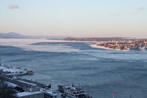
The evening we arrived we climbed up to the Plains of Abraham for a big-picture view of the river. I don’t think you can see how cold it was, but you can see the wind on the water:

The next day we decided to get a close-up view of the ice, and we took the ferry across to Lévis. You can see the ferry at the bottom of the picture above. The ice was pretty thick, and the ferry had to push through the floes.

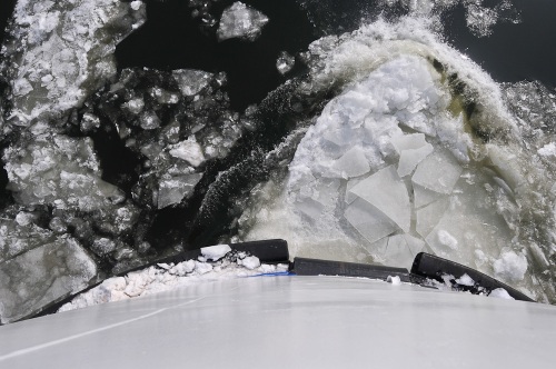
Some of them were big enough that the boat would shudder as it crashed into them:

Approaching Lévis:

Looking back toward Québec:

Looking at this view, I pretended I was on the deck of an Arctic icebreaker:

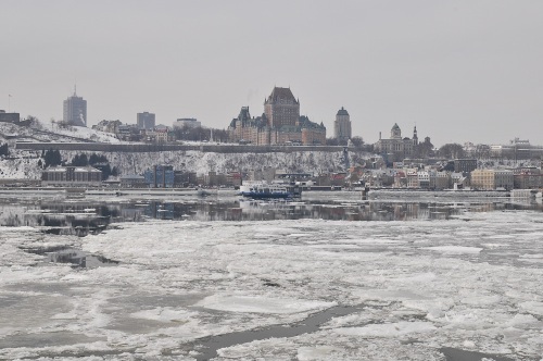
Québec and the Château Frontenac:

Back on the Québec side, we looked across to Lévis. Here you can see both ferries cutting paths through the ice:

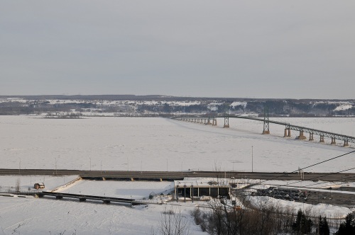
A few miles to the east the St. Lawrence splits around the Île d’Orléans. The shipping channel runs to the south of the island, and the north side is allowed to ice over completely: