Feeds:
Posts
Comments

Posts Tagged ‘new york’

Six years ago, Karen and I headed up the Hudson River (by car) to find ice. Three years ago we had to go farther north, to Québec City, to find ice. This year the ice came to us.

Today, with the temperature around 16 degrees Fahrenheit and the windchill somewhere south of zero, we took a tour with the New York City Audubon Society and New York Water Taxi to look for birds and harbor seals. We found wind (30–35 knots, with gusts much higher), waves, and lots of ice.

Icy harbor

Water taxi in the ice

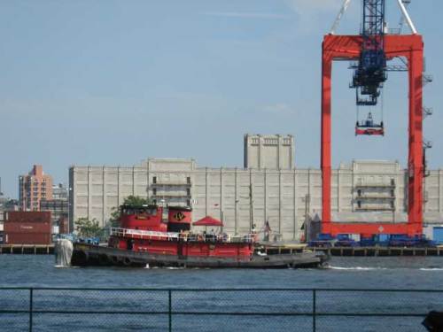
The tug Chesapeake Coast enters the Buttermilk Channel between Governors Island and Brooklyn:

Chesapeake Coast

At least the ice helped calm the water:

Frozen buoy

Here’s a close-up of the ice at the entrance to Erie Basin:

Frozen harbor

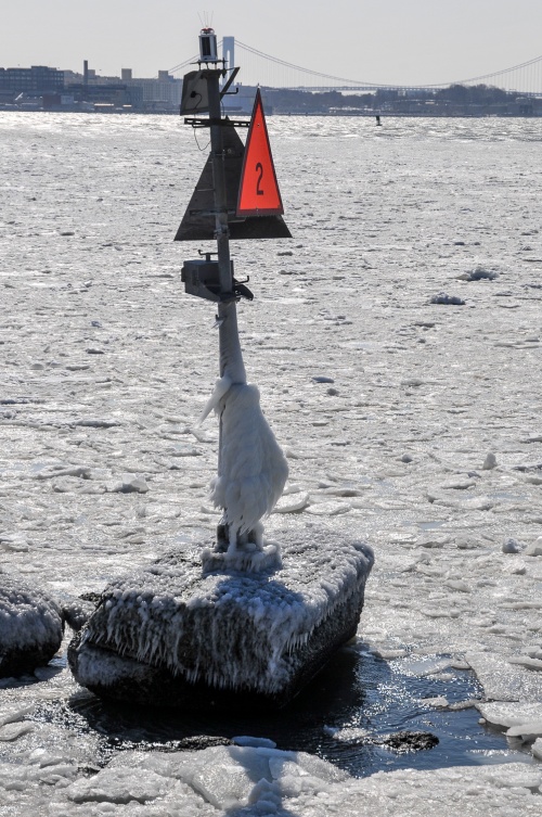
And here’s the buoy marking the entrance:

Ice-covered buoy

After poking around in Erie Basin, we headed through the Narrows to Hoffman and Swinburne islands to see if we could find harbor seals. This is the crumbling pier at Hoffman Island (no seals):

Frozen pier

Then on to Swinburne Island. Still no seals (although the Audubon Society naturalist leading the tour claimed to have seen one poke its head up behind us), but plenty of birds:

Birds at Swinburne Island

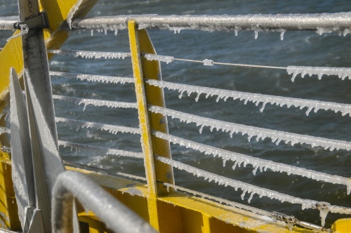
This is what the boat looked like when we got back to the South Street Seaport:

Icicles

Frozen boat

All in all a fun trip (the free hot chocolate helped a lot), and we did get to see some arctic birds that are only here in the winter.

Read Full Post »

This past Sunday, Karen and I joined a group of volunteers on a marsh restoration project in Jamaica Bay, organized by the American Littoral Society and other environmental groups. About 85 percent of the wetlands in Jamaica Bay have disappeared, resulting in lost habitat for fish, birds, and other wildlife. In addition, wetlands provide natural flood control, which the community of Broad Channel, Queens, could have benefitted from during Hurricane Sandy. For more on the project, click here.

Sunday was cold, windy, and rainy, but we decided to go anyway, knowing we would regret missing the opportunity to be part of the first ever community-led restoration project on national land (Jamaica Bay is part of the Gateway National Recreation Area). To get to Rulers Bar Hassock, where the Spartina marsh grass was waiting to be planted, we had to take a boat from Broad Channel to a float moored just off the island. We then pulled the float as close to Rulers Bar as we could get it and waded through ankle-deep water and mud to the island:

rulers bar-1

Here we are on the island, dressed for foul weather:

rulers bar-3Rulers Bar is eight acres of sand that gets covered twice a day by the high tide. The Spartina plugs get planted two feet apart and a few inches deep. It’s amazing that the tide doesn’t wash them away. The plugs along the fence are still in trays, and plugs planted the day before are arranged across the sand in rows:

rulers bar-4There’s a lot more island to cover:

rulers bar-2

Rulers Bar HassockIf I remember correctly, the plan is to plant 88,000 plugs, with a goal of 85 percent survival to next year. More than 10,300 plugs were planted last weekend.

The proces is quite simple: make holes in the sand, remove plugs from the tray, place one in each hole, cover with sand and pat it down. The tool for making the holes is a dibble. Here Karen gets her dibble on:

rulers bar-6What is the collective noun for a group of volunteers? An army? A horde? A scattering? Anyway, the turnout on Sunday was quite large, especially given the weather:

rulers bar-7There are three more days of planting. To join the fun (and do some good) click any of these links:

May 25th, 11 am – 3 pm

May 26th, 12 pm – 4 pm

June 2nd, 10:30 pm – 2:30 pm


Read Full Post »

The Urban Assembly New York Harbor School is one of New York City’s public high schools, dedicated to using the harbor as an instructional tool. It used to be located in Bushwick, Brooklyn, about as far from the harbor as one can get and still be in New York City. Today was the official opening of the school’s new Governors Island facility, a former Coast Guard building that has been beautifully renovated—an opening complete with the ceremonial cutting of, not a ribbon, but a fishnet.

It was chilly and rainy, but the ceremony was held outdoors. As Harbor School founder Murray Fisher explained, since the ninth-graders were at that moment out on the water on the schooner Pioneer, we should also be outside. The SUNY Maritime band played the anthems of the U.S. armed forces while we waited for the ceremony to begin:

The flags didn’t mind the rain:

Nor did the plants in the school’s garden, a joint project of the art and science classes:

The Sustainable NYC class at Fordham University worked with the Harbor School students to plant the garden and procured most of the plants.

Various dignitaries attended, including New York State Senate Majority Leader John Sampson, State Senator Daniel Squadron, Congressman Jerrold Nadler, New York City Council Member Margaret Chin, Schools Chancellor Joel Klein, and Mayor Mike Bloomberg. Here Nathan Dudley, the school’s principal, addresses the attendees (with Murray Fisher on the right):

Chancellor Klein spoke:

Students listened, some in the rain:

And some from their classrooms:

Finally, Mayor Bloomberg came to the podium as the rain got serious about falling:

The fishnet was cut with golden scissors:

We were rewarded with “light refreshments” for standing in the rain. This being the Harbor School, the refreshments included oysters:

One project of the school is the reintroduction of oysters to New York Harbor, a necessary step for cleaning up the harbor. These oysters did not come from their project (we think).

The Harbor School is the only school in New York with this view from its cafeteria:

And it’s also the only school in New York whose students get to see this every day on their way home from school, as they ride the schoolferry:

Read Full Post »

World’s End is the third novel by T. Coraghessan (now T.C.) Boyle, published in 1987. The title refers to a point on the Hudson River just above West Point, which we passed on our trip last July. Very briefly (because it’s hard to do justice to the plot in a short space) it’s the story of three families — the Van Brunts, the Van Warts, and the Mohonks — in the late 1600s, 1949, and 1968. Most of the action takes place in the Hudson Valley, near the fictitious town of Peterskill (which bears a remarkable resemblance to the actual town of Peekskill). Boyle assembled his book non-chronologically, jumping back and forth in history, which allows us to experience New York when it was a Dutch (and then English) colony, to be there for the riots at the Paul Robeson concert, and to enjoy the parallel histories the characters experience.

There’s just enough magic (or magical, if you prefer) realism to make you grin when you come across it (if you like that kind of stuff), but not so much that you groan and wonder if you’re reading Gabriel García Márquez by accident. I don’t want to call World’s End a sprawling epic, because I don’t want to frighten potential readers, but it is a sprawling epic (well, epic in scope, not in size). It has everything: the weight of history, fate and destiny, familial expectations and obligations, murky moral choices, tragedy, and even a literary version of the Hudson River sloop Clearwater.

Let the first sentence be your invitation:

On the day he lost his right foot, Walter Van Brunt had been haunted, however haphazardly, by ghosts of the past.

Open the door and enter this world that is both familiar and exotic.

Read Full Post »

Today Karen, the kids, and I went to the New York Transit Museum to participate in a special program in connection with the exhibit “Last Day of the Myrtle Avenue El: Photographs by Theresa King.” After the photographer talked to us about her pictures, the kids borrowed digital cameras, and we headed out to see what Myrtle Avenue looks like today.

I wandered around the museum and was surprised to stumble upon the old control panel for the Harlem River Lift Bridge. This panel was made in Schenectady, New York, by General Electric and was used from 1936 through 2000:

control-panel-1

Here are some details.  This is the normal control master switch:

master-switch

Here is the normal skew indicator:

skew-indicator

This is the hand level-up switch:

level-up-switch

And this is the Harlem River Lift Bridge (part of the Robert F. Kennedy Bridge, ex-Triborough Bridge). It was taken during our first circumnavigation of Manhattan in Puffin.

harlem-river-lift-bridge

Read Full Post »

On August 1 Karen and I made a triumphal (okay, maybe it wasn’t triumphal) return to Governors Island, this time with the kids in tow. Unfortunately, we were not able to take Puffin, so we joined the huddled masses on the ferry from the Battery Maritime Building, all yearning to breathe free on the lawns and promenade of the island.

In 1809 Washington Irving, in A History of New-York, from the Beginning of the World to the End of the Dutch Dynasty; Containing, among Many Surprising and Curious Matters, the Unutterable Ponderings of Walter the Doubter, the Disastrous Projects of William the Testy, and the Chivalric Achievements of Peter the Headstrong—The Three Dutch Governors of New Amsterdam: Being the Only Authentic History of the Times that Ever Hath Been or Ever Will Be Published, bemoaned the fact that Governors Island, “once a smiling garden . . . was now covered with fortifications” so that it “resembled a fierce little warrior in a big cocked hat, breathing gunpowder and defiance to the world!”

I’m happy to report that, although the fortifications remain, the gunpowder and defiance seem to be gone.

fort_jay

The island is aswarm with peaceful New Yorkers and visitors who roam everywhere by foot, bike, scooter, and other human-powered wheeled transport. In fact, it was the bicycles that lured us to Governors Island this time. We were hoping to rent one of Bike and Roll‘s quadcycles, but we were much too late, and there weren’t any available. Instead, we each got a bicycle—mountain bikes for the kids, and fancy, orange Dutch bikes for Karen and me.

gi_bikes

Riding the complete perimeter of the island is easy due to the lack of hills and the lovely breezes off the water.

gi_promenade

There are plenty of places to stop and lots of grass to rest on. If you go on Fridays, you can get a bike for an hour for free, and Bike and Roll has just added 50 more bicycles to its fleet. (Here’s a question, though: How come they get to charge for the orange bikes? They were donated to New York City by the Dutch government.)

At any rate, it was another thoroughly enjoyable afternoon on Governors Island. Next time we’ll bring our own bikes, though.

Read Full Post »

Here’s a pictorial review of City of Water Day.

This is the tug Pegasus, heading toward Erie Basin or Gowanus Bay on a tour:

pegasus

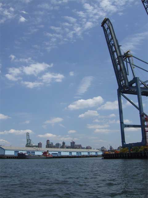
Karen got this dramatic shot of the Mary A. Whalen and one of American Stevedoring‘s gantry cranes:

whalen

They’re one of the companies keeping the working waterfront working.

Here’s another shot of Puffin, secure at Pier 101. That’s Karen standing in the stern:

puffin_101

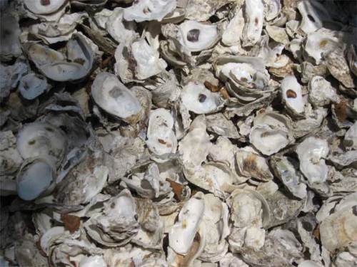
There was an exhibit on Governors Island discussing the role of the oyster in the ecological and commercial history of New York City. It also explained the efforts to bring the oyster back to New York Harbor. Accompanying the exhibit was a small oyster shell midden:

midden

To learn more about oysters and New York City I highly recommend Mark Kurlansky‘s The Big Oyster: History on the Half Shell. (Yes, I know. That’s the second time I’ve recommended a Kurlansky book. I’m not on his payroll; I just really like his stuff.)

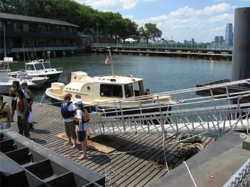
The scene at the boat landing:

kayaks

This plaque commemorates the purchase of Governors Island by Wouter van Twiller in 1637. The remarkable thing about the plaque is that it mentions the names of the two Manahatas from whom the island was purchased:

plaque

Here’s good old Wouter (second from left, I’m guessing):

Wouter_van_Twiller

I wonder what “two axe heads, a string of beads and a handful of nails” would buy today.

The tug Cornell passes the Brooklyn waterfront:

cornell

Governors Island is also hosting various art installations. This is one—made up of light and smoke—inside the chapel:

art

For a lot more information about Governors Island, and particularly for some fantastic historic maps and images (including one of Wilbur Wright taking off), go to the Web site of the Governors Island Preservation and Education Corporation (GIPEC).

And if you, like us, would like docking for recreational boaters to be part of Governors Island’s future, please let GIPEC know.

For more pictures from me and Karen, visit my web gallery.

Read Full Post »

Today was City of Water Day in New York, sponsored by the Metropolitan Waterfront Alliance. Hundreds (thousands?) of people came to Governors Island just off the Battery by ferry, canoe, kayak, rowing gigs, and one lone private powerboat.

Karen and I arrived at Pier 101 in Puffin around 1:00 p.m. We tied up at one dock but had to move to make way for bunches of kayakers. The next spot was too close to some beautiful wooden rowing boats, so we moved to a third spot. This one was a bit bumpy as the ferries came and went, but we put out all our fenders, and the boat is secure:

IMG_5123_sm

City of Water Day looked to be a tremendous success. Tons of people were on Governors Island, listening to music, fishing, seeing art installations, and visiting with representatives of local water access advocacy, educational, and environmental groups.

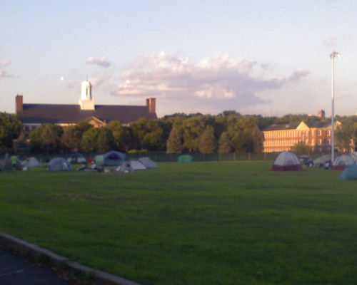
We are now camping on the ballfields with a couple hundred paddlers and rowers. The view of Jersey City is very nice. (We’re too far south on the island to see Manhattan.)

When I first came ashore this afternoon I planted my flag and announced, “I claim this land in the name of recreational boaters.” GIPEC, are you listening?

photo 071809 001

Read Full Post »

It’s been an awfully long, wet spring. Today was the first time this season that we took Puffin out into Jamaica Bay. It was a quick jaunt over to Rockaway, then east under the Cross Bay Veterans Memorial Bridge (non-movable), where we got this view of the A train heading to Manhattan over this non-DOT swing bridge.

IMG_5112_sm

Later, while we were docked at the Wharf, our favorite Jamaica Bay restaurant (because it has a dock), we saw the swing bridge open to allow a Sheepshead Bay party boat to pass through.

Here’s Puffin in her usual spot at the Wharf’s dock:

IMG_5115_sm

We made a nighttime crossing of Jamaica Bay back to our marina and closed up the boat just as a few raindrops started to fall. A perfect day.

Read Full Post »

Welcome to A Movable Bridge at WordPress. To read previous posts please visit my original location.

Read Full Post »